
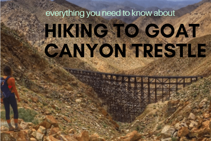
For those of you who haven’t heard of the Goat Canyon Trestle hike, it’s an extremely difficult hike through the Anza-Borrego desert to the largest free standing railroad trestle in the world (if you don’t get lost).
I hike a lot, but I never have gotten as lost as I did while hiking to Goat Canyon Trestle (and I did it twice).
This is a common story, most people do get lost while attempting Goat Canyon, unless you go with someone that’s done it previously. The trail isn’t marked, and due to the desert terrain, it’s hard to tell the difference between the trail and the desert wash. You need to do your research before attempting this hike. PS. Please don’t attempt this hike if it’s super hot and always make sure to bring enough water.
Okay enough with the warnings. This post will help you not to get lost on the Goat Canyon Trestle hike..but you probably still will, so listen closely.
There are two ways to do Goat Canyon Trestle:
- You can hike the tracks. I didn’t go this way because I’m stubborn, and also because I’d prefer to hike a trail rather than tracks. This route is easier but also significantly longer. If you would like to go this way, I suggest looking at Google Maps to follow the tracks. It’s also illegal, if that matters to you.
- The actual trail (read below).
Stats:
- 6 miles round trip
- 2500 feet of elevation gain, not to mention bouldering over rocks. No exaggeration, be prepared for a full body workout. This route practically involves rock climbing.
How To Get There
Begin by setting your destination address to: 32.718916,-116.141024 in Google Maps (or click on the map below).
Make sure that you bring a phone charger with you and have it plugged in during the car ride. You will need to conserve battery on this hike. Put in the address before you get too remote, because you will likely lose service along the way. Once you look at Google Maps, it should look like this:
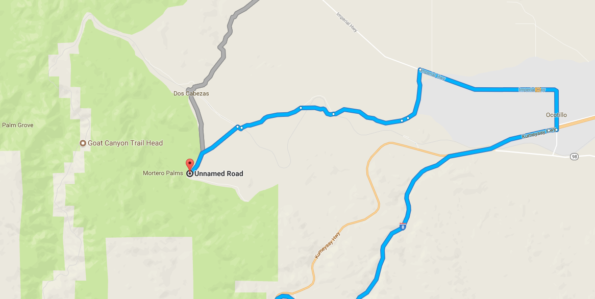
You will get off the 8 at Ocotillo, turn onto Imperial Highway, then make a left on Las Cabezas road (which won’t have a sign so follow the GPS). From here on out, you will be on dirt roads. Keep following the GPS to Montero Palms.
It’s a good idea to look at the Google Maps in 3D mode before you go, so you have an idea of where everything is at. I would actually go slightly beyond where the gps leaves you off, and you will see the road end in a type of cul de sac:
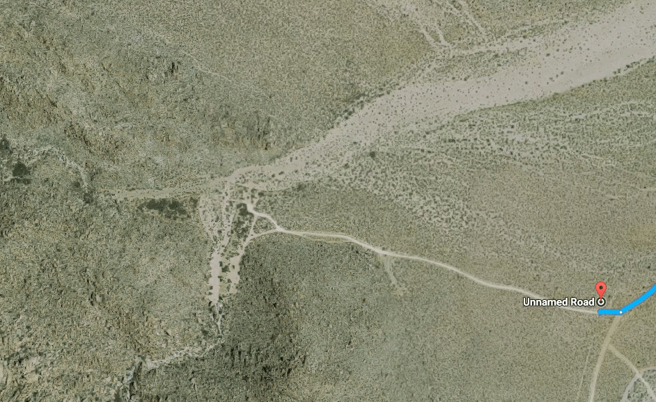
The Goat Canyon Trestle Trailhead
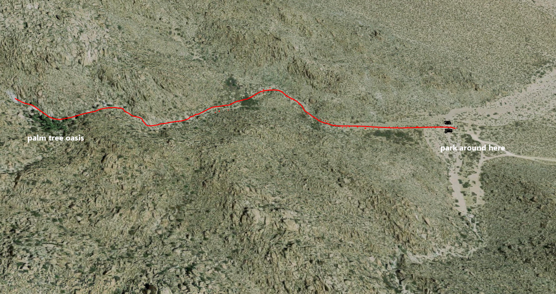
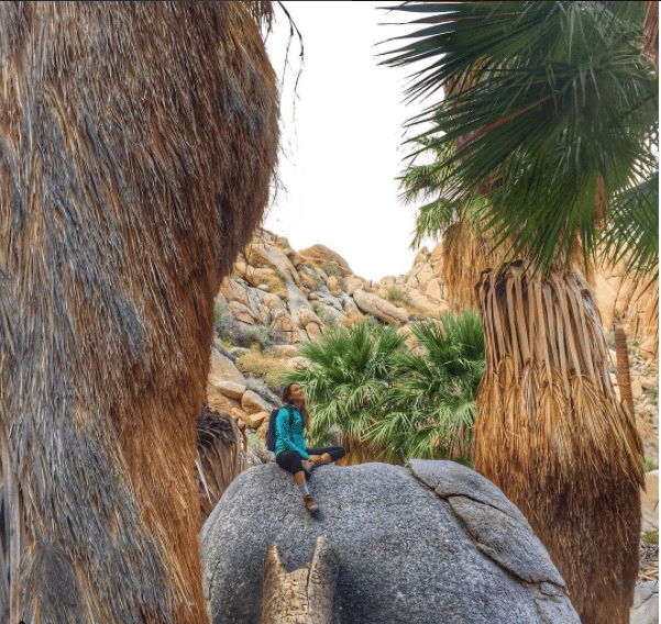
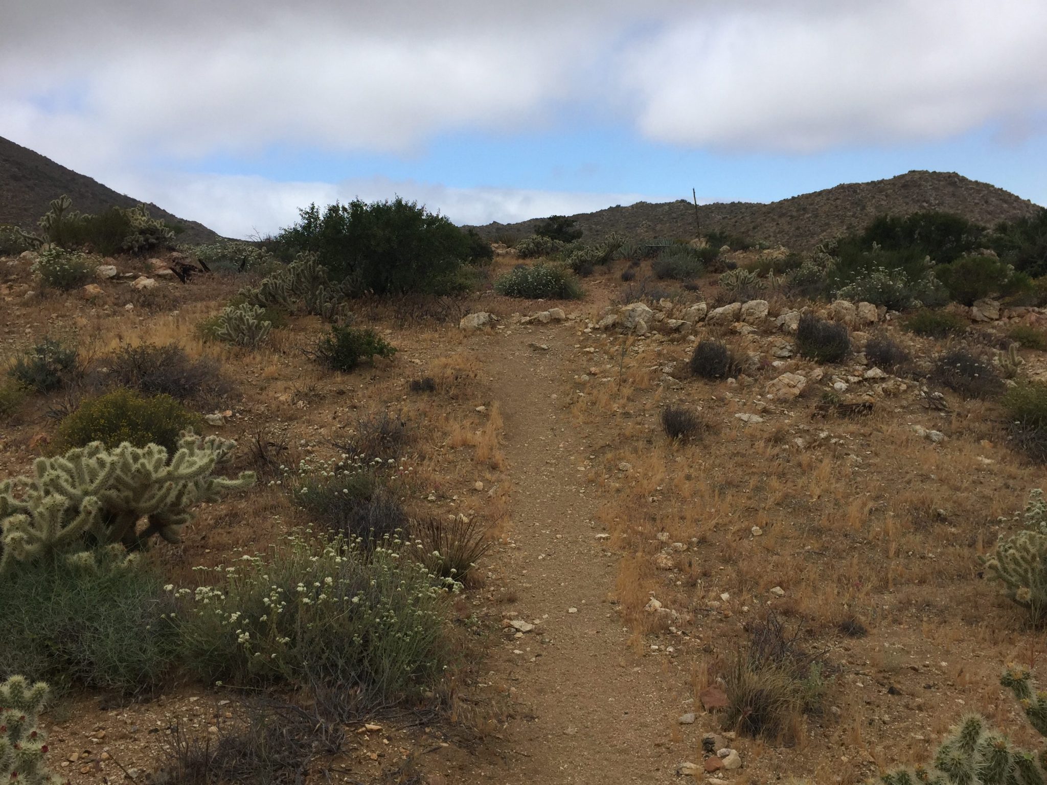
Starting the hike on the right trail is one of the most important parts. If you screw this part up (and I have), you will have a really really difficult time finding the real trail, so pay attention. Park somewhere around the loop shown below. Then, you should see two rods sticking out of the ground around here (I marked them in black in the map above). This is where the start of the Goat Canyon Trestle hike is. You may second guess yourself, but your goal is to hit the palm tree oasis shown below. Once you hit that, you know you’re on the right track.
The Goat Canyon Trestle Hike
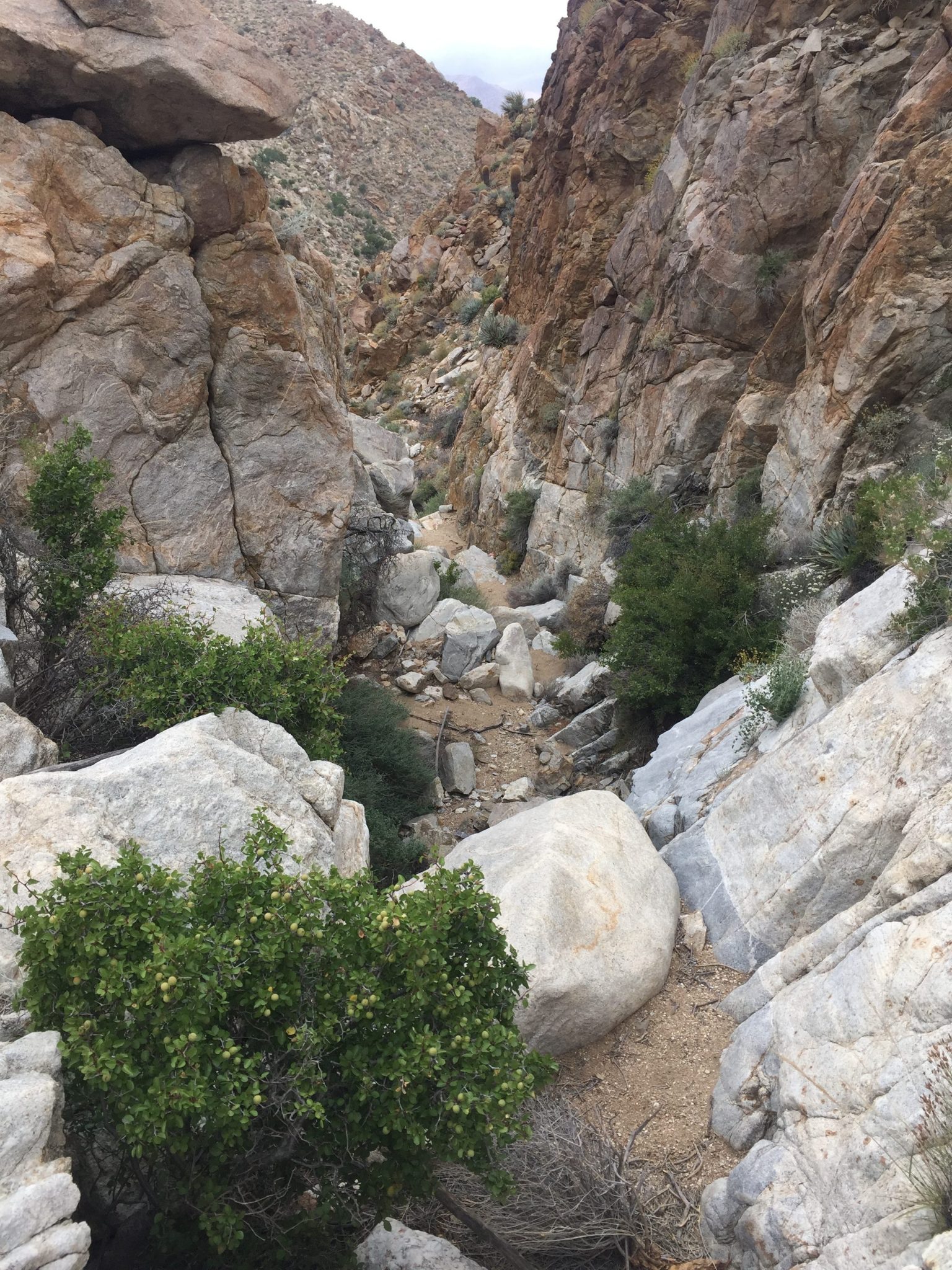
After making it out of the palms, the next step is a series of dried up water falls. This is where the boulder scrambling begins, and believe it or not, it was my favorite part. I felt like a little kid climbing over these massive rocks.
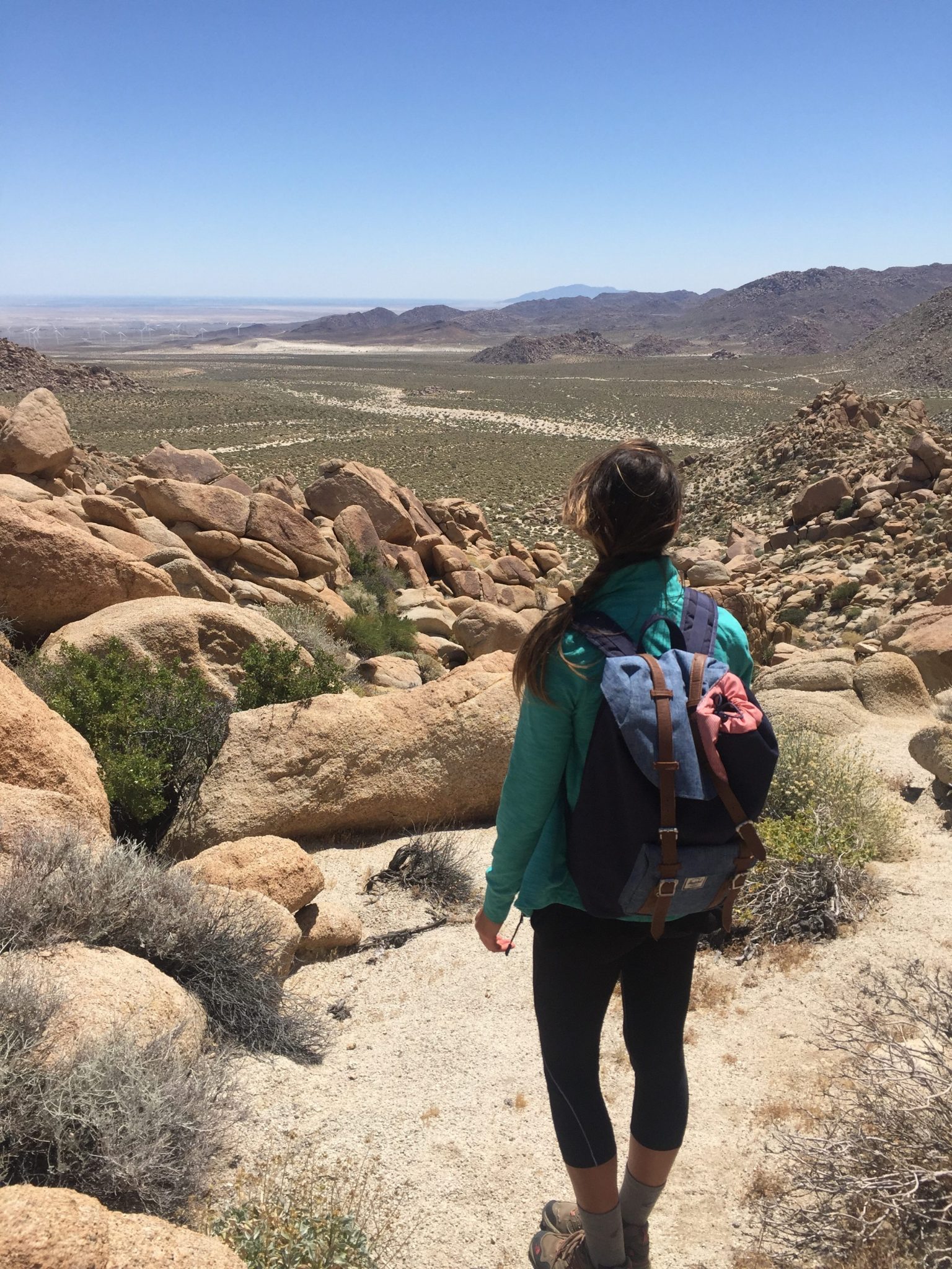
Once you tackle this first obstacle, you will continue into a small valley and then up another steep and rocky section. Don’t forget to stop and look behind you for a few pictures. Just don’t take too many since you need to reserve your cell phone battery.
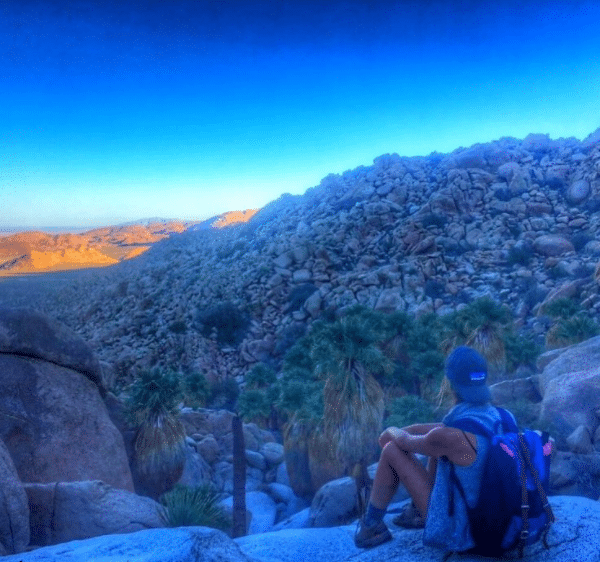
Continue climbing and then you will eventually reach a plateau with a view into a valley. Keep hiking and you will eventually reach a second saddle (if you are still using your GPS, you will see that you are right on the border between Palm and Goat Canyon).
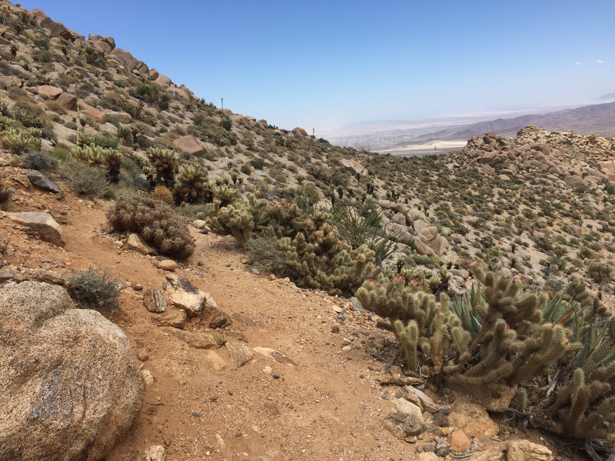
Begin to descend in elevation into the canyon, keep an eye out for signs that people have left out regarding the route. For me, there was a tree pointing to the right once we descended.
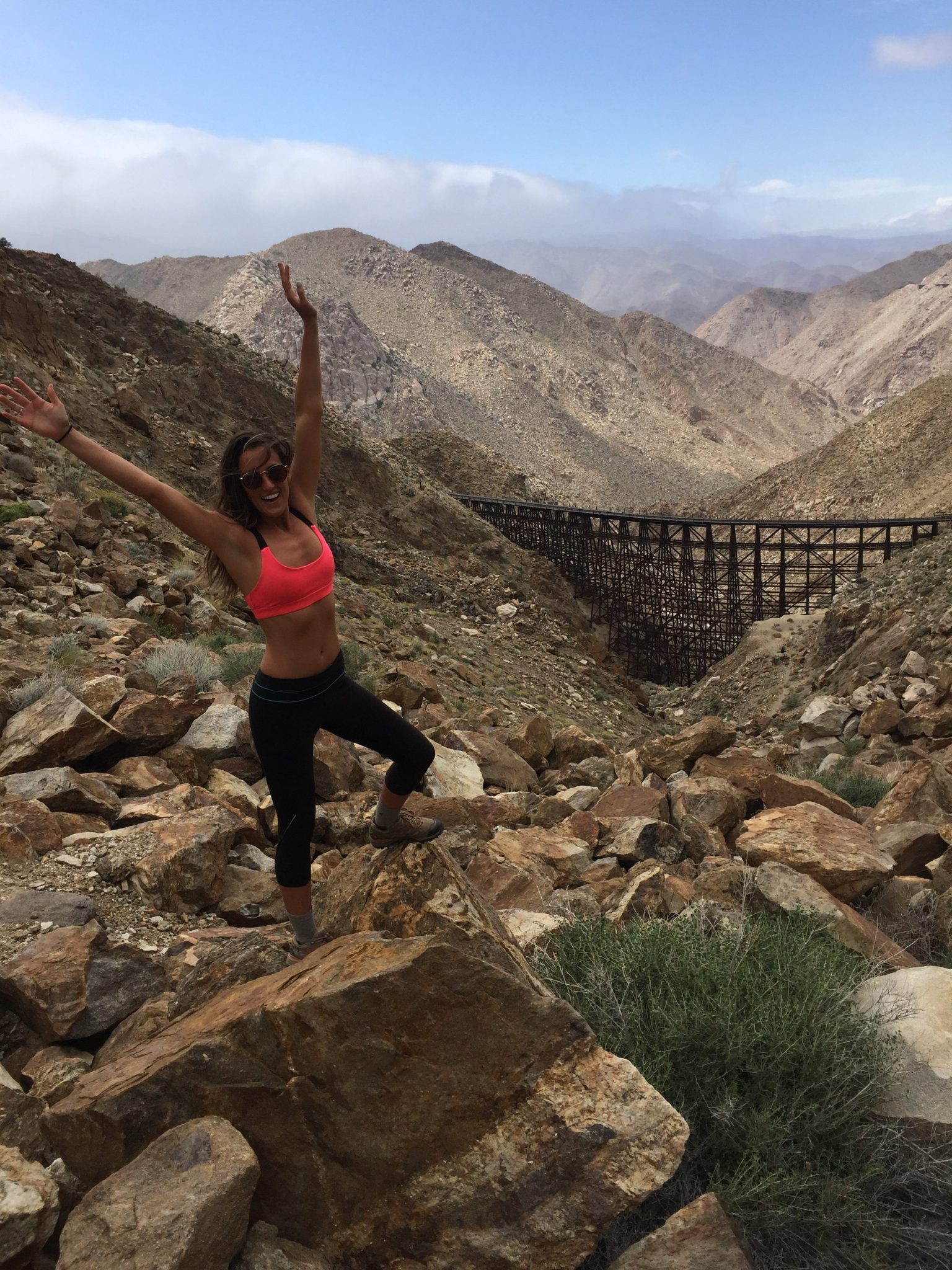
Keep following the path and you will reach a very steep boulder field, and your first view of Goat Canyon Trestle.
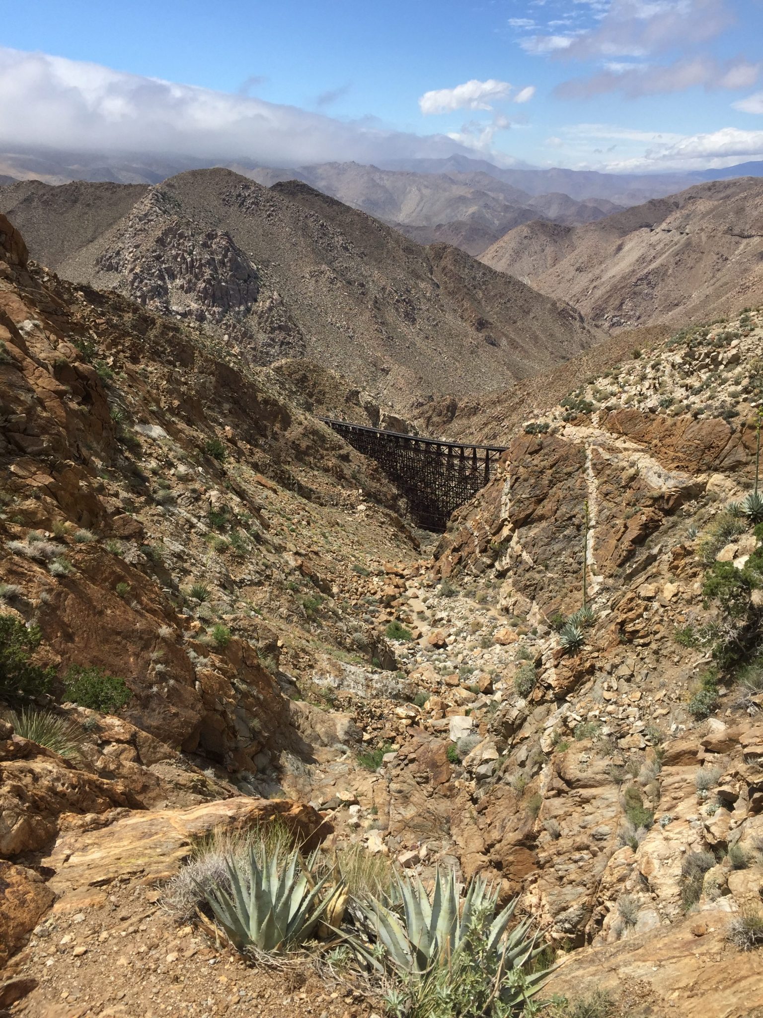
There is a 50 foot dry fall below this spot that makes reaching the trestle very difficult. Be extremely careful in this spot, I was causing miniature rock slides.
Now, turn back and do it all again to get back to your car. If you left markers (which I recommend doing) this will be a lot easier and ensure that you don’t get lost. Please don’t leave anything not natural to the environment on the trail. Some people tie colored markers on trees or mark signs in the sand. You can also make cairns (or stack rocks).
Things I Highly Recommend Bringing on the Goat Canyon Trestle Hike
- Sturdy hiking shoes (I wore these)
- A lot of water
- Sun protection
- A positive attitude (Yes it’s cheesy, but getting lost a million times can be really discouraging. Keep your head up!)
- A first aid kit (The first time I got stabbed by a sharp agave plant and the second I slammed my hand into a cactus).
- Solar powered battery charger
Things to be Careful About
- Weather: Rain can cause flash floods in this area and high wind on top of the mountains is also pretty dangerous. I was getting blown around, which isn’t ideal when you’re surrounded by cacti. If it’s too hot, don’t attempt this hike. There is no protection from the elements on this hike.
- Rattle snakes, yes I saw one on this hike
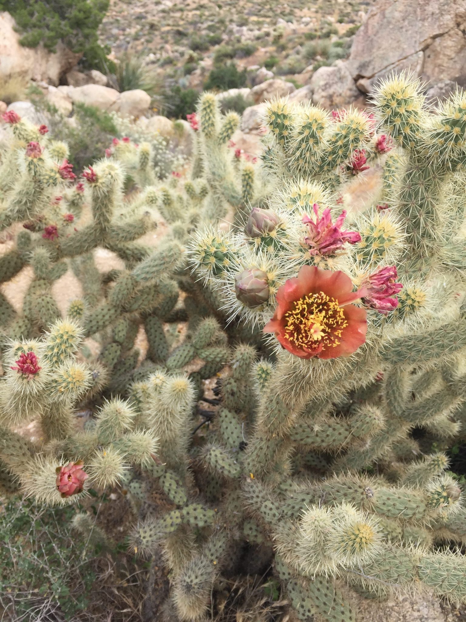
- Desert plants – be careful around all of the cacti and agave plants on this hike. They are really really sharp and you don’t want to be pulling them out of your nail beds (sorry for the visual).
Preparing Beforehand
Like I mentioned earlier, I would recommended putting the GPS units in your phone before you lose service. I would also highly recommend dropping a pin where Goat Canyon Trestle is located. This way, even if you get lost on the trail and don’t have service, you will still be able to use Google Maps to tell where you are in relation to Goat Canyon Trestle.
Reward Yourself After
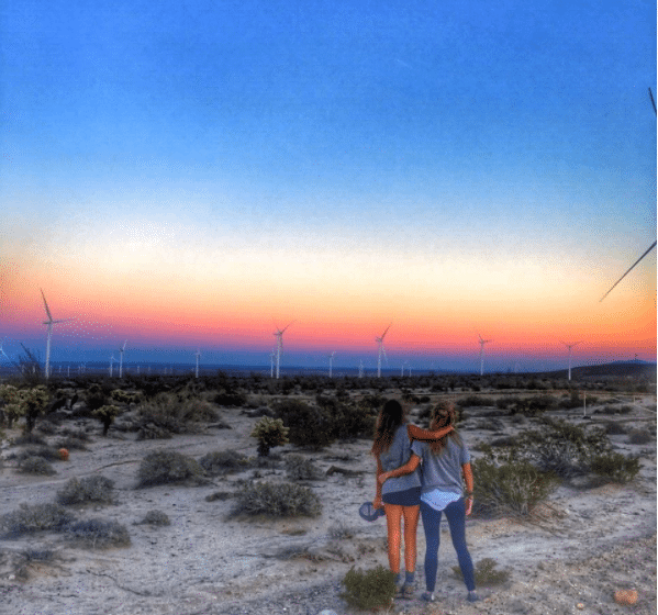
Catch the sunset over the field of windmills on your way out of the desert. If you have time and a designated driver, stop in the tiny Lazy Lizard saloon in Ocotillo and grab a beer with the locals!
Some History on Goat Canyon Trestle
The railroad itself was referred to as “the impossible railroad” back in the 1900s, due to the difficult nature it had to transcend. It was completed in 1919, connecting San Diego and Yuma. Due to the cave in of a tunnel in one of the Jucumba Mountains, engineers decided that a trestle would be a better idea. Goat Canyon Trestle was finished in 1932, standing at 200 feet high and 600 feet long. It is the largest freestanding wooden trestle in the world.
Unfortunately, the pounding rain and vicious winds of Hurrican Kathleen were too much for the railroad, collapsing tunnels and tearing up trestles. Southern Pacific Railroad decided to cut their losses and abandon the project. The trestle still sits unused.
Have any questions on the Goat Canyon Trestle Hike? I’d be happy to answer them below!


Hi, thanks for publishing this excellent blog.
It is very helpful as i now realise that this trek will be too strenuous for both myself and my wife.
I suspected this anyway just by walking over the terrain on google maps.
You also mentioned that it is illegal to walk the track route to the trestle, any idea how much they monitor any activity regards this.
We shall be driving through the area in October and ‘may’ consider a short walk on the tracks up to one of the first trestle bridges.
Hi Graham,
You’re welcome, I’m glad you liked the post. The hike is a little strenuous with all of the bouldering. It is illegal to walk the track route, but I have several friends that did it that way without any trouble (although I can’t make any guarantees!) If you’re in the area of Anza-Borrego, Fonts Point is also worth a view and the ATVing around there is amazing!
Good luck!
Marteen